
COAST RIDGE / BIG SUR, Monterey County — October 30, 2026. Months after the Timber Fire began on August 8, a different phase of the emergency has directly affected the Coast Ridge corridor: crews have been repairing fire lines, grading affected roads and moving heavy equipment out of the mountains. The official incident archive last updated October 20 lists the fire at 25,352 acres and 97% containment. That is substantial containment, but not the same as an official declaration that the fire is fully out.
The latest published incident summary is a dated agency record, not a live October 30 observation of work along every mile of Coast Ridge Road. Its value for neighbors lies in documenting where crews were working, why heavy equipment continued to be present after the main firefighting phase, and why road access and evacuation status must be checked separately.
What changed on Coast Ridge Road in early October?
The Timber Fire agency log specifically mentioned Coast Ridge Road on October 1 as an area where suppression repair continued. It described heavy machinery and hand crews addressing ground disturbed by firefighting operations, with particularly difficult work on the steep southern section. On October 3, dozer-line repairs were progressing along Coast Ridge Road, while personnel also worked on Skinner Ridge and in other isolated areas. Resource advisers were reviewing repaired routes for environmental impacts.
On October 4, the official log said cultural-resource advisers and tribal representatives were helping guide work in sensitive areas, with an experienced Chumash crew expected to assist. By October 7, the log stated that Coast Ridge Road was being graded while crews moved north along the west side. The same update noted that south-side dozer-line repair was complete and that patrols continued along Highway 1. These are specific historical milestones, not proof that an entire public road was rehabilitated to its permanent design standard.
What does suppression repair mean?
Fire suppression can leave temporary dozer lines, disturbed slopes, damaged fencing and rutted access tracks. Suppression repair is the work of reducing those impacts: regrading or stabilizing disturbed routes, repairing fencing and firelines, managing erosion risk and removing materials where doing so is safe. It is distinct from construction of a new public road, a privately funded driveway repair or a county paving program.
For Coast Ridge and other steep Big Sur mountain areas, winter precipitation makes erosion and unstable slopes especially relevant. However, the published agency reports do not quantify the exact volume of soil moved, identify every private landowner affected or establish that a specific drainage channel was made safe. Those outcomes require site-specific inspections and work records.
What did the October 20 fire figures show?
The agency’s October 20 last-update timestamp carried a reported 25,352-acre footprint and 97% containment. Its October 18 entry says there was no reported acreage or containment change. On October 8–9, crews were still monitoring isolated smoldering or creeping in heavier fuels and working to secure containment lines, even as most of the fire showed little activity. The incident remained under Los Padres National Forest jurisdiction, with CAL FIRE relaying information. The archive listed the cause as under investigation.
A reader should not interpret 97% as a forecast that the fire will be fully contained within three days, or use a stale perimeter screenshot to decide whether smoke is a new ignition. For an immediate threat, call 911 and consult updated incident information.
Evacuation orders and forest-road closures are separate
An October 7 incident update said all remaining evacuation orders had been lifted. That is an important safety-development record, but it does not say all evacuation warnings were lifted at the same time, and an evacuation order being lifted does not automatically reopen National Forest roads or trails.
The U.S. Forest Service’s separate Monterey Ranger District Emergency Closure Order 05-07-51-26-11, issued September 26 and scheduled to run through January 31, 2027 unless changed, covers designated forest roads, trails and areas including parts of the North, Central and South Coast Ridge routes. Those federal closures and their exceptions must be checked using the actual order and map; the Coast Ridge/Carmel Sur residential service area is not the same legal entity as every road bearing the Coast Ridge name. Authorized access to private property can also differ from recreational access to closed forest land.
How residents and visitors can verify access
Check the official incident archive, the Los Padres National Forest alerts and closure orders, and Alert Monterey County for current warnings and zones. State Highway 1 conditions are handled separately by Caltrans QuickMap. Do not drive around federal closure gates or assume a graded former fireline is now a public driving route.
Primary source: Timber Fire incident log, October 1–20, 2026, including Coast Ridge Road repair reports, October 7 evacuation update and dated containment figures. Records reviewed October 30; California58 has not independently inspected the road, obtained private-property damage assessments or confirmed the current work-completion status.
Corrections and local documented updates: California58 Newsroom.
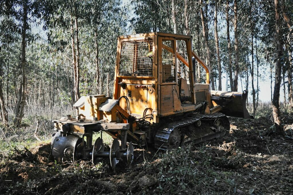
Featured photograph: illustrative forestry work by Paulo Silva / Unsplash. This is not a photograph of Coast Ridge Road, the Timber Fire, or specific October 2026 repair work.
Help this community newspaper grow
Your support helps build coverage for the people and places this local newspaper serves.
Donate once by card ↗Support Coast Ridge News
Choose how to support Coast Ridge News:
Credit / Debit Card via StripeChoose an amount from $1. One-time support through the publisher's LINKERNO Stripe account.
Continue with PayPal Continue with ZelleZelle payments go to Vitaly Ataev Troshin. Please verify the recipient in your bank before sending. Availability depends on your bank.
Optional reader support. When possible, add “Coast Ridge News” to the payment note. Contributions are not advertised as tax-deductible. Support does not influence editorial decisions.More from Coast Ridge News
- Coast Ridge Visitor Guide: Garrapata State Park Allows Dogs Only at Gate 19 Beach, Not on Soberanes Trails →
- Near Coast Ridge, Garrapata’s Rocky Ridge Trail Plan Clears Environmental Review: Five Miles Re-Routed, Three Miles Retired →
- Big Sur Coastal Camping Proposal Would Add Two Tent Areas and Outdoor Classrooms; October 13 Review Was Not Final Approval →
- Coast Ridge / Carmel Sur Drainage District Included in Monterey County’s 2026–27 Assessment Roll →
COMMUNITY
Comments
Join the California58 conversation. You must be signed in to comment.
Create a free California58 account or sign in with an available social provider.